and Chasing
[Index][Archives]
Tornadoes 24 May 2004 Nebraska
by Jimmy Deguara
| Storm News and Chasing [Index][Archives] |
Tornadoes 24 May 2004 Nebraska by Jimmy Deguara |
May 24 2004 Southern Nebraska strong tornado and landspouts
All pictures from the 24th May 2004 are on this page
 Not often does one exit the warm front with a tornado watch box in process during the late morning. I guess the atmosphere was loaded with ample moisture and heating was in progress � all it took was an upper level trough to release this energy. The wind shear was powerful with south to southeast winds already fresh to strong. Having started out the day near Grand Island, the target was far southeast Nebraska.
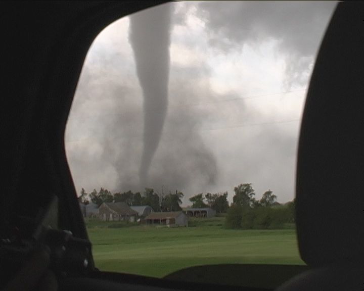
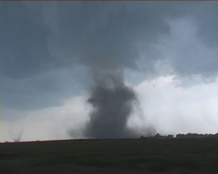
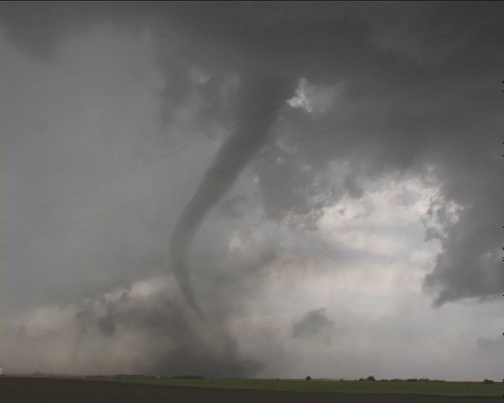
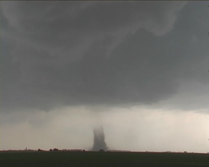
 Any storm that took off near the triple point was set to explode and become severe rapidly. But what I had not anticipated was that a tornado would already be in progress by the time we caught the base of the storm. On the final approach to a good, safe vantage point with respect to the storm, another spin up had occurred � simultaneously!! The funnel descends toward the dust whirls but only one tornado persists for a few minutes. After yet another touch down, the impending hail forces a hasty retreat south.
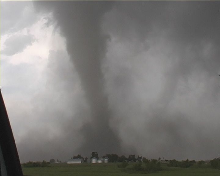
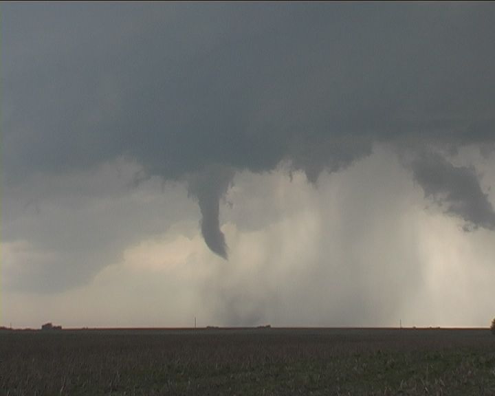
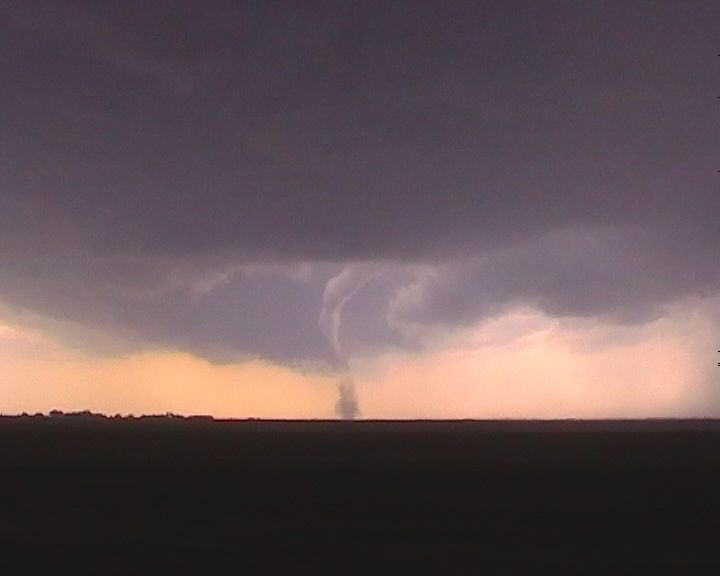 Another touch down � tornado number 4. It scoured the earth into an impressive dust plume. More dust in the field to its north. What - another one? This was almost unrealistic - confusing. At first I thought it was a weak circulation. Having repositioned a couple of hundred metres further down the road past a farm house and silo revealed a different perspective. This was no weak circulation. Looking north, it was almost like slow motion � disbelief? A tornado had rapidly developed in the field nearer the house � the rotating funnel overhead confirmed that. It all made sense. The silo made a big clang as it was removed from its foundations and hammered into other objects. What the hell were we doing here � it was close. �Let�s go.�
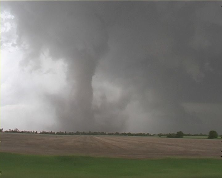
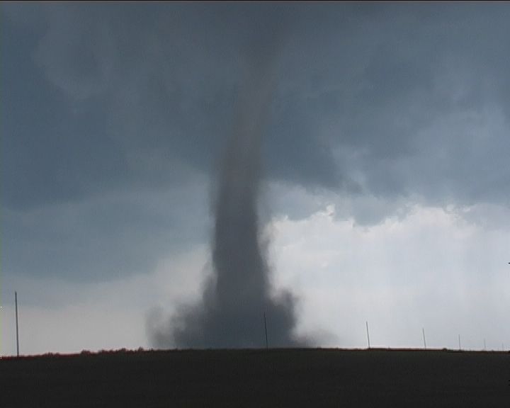
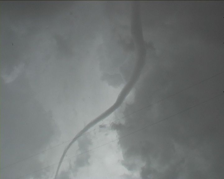
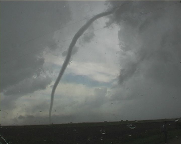
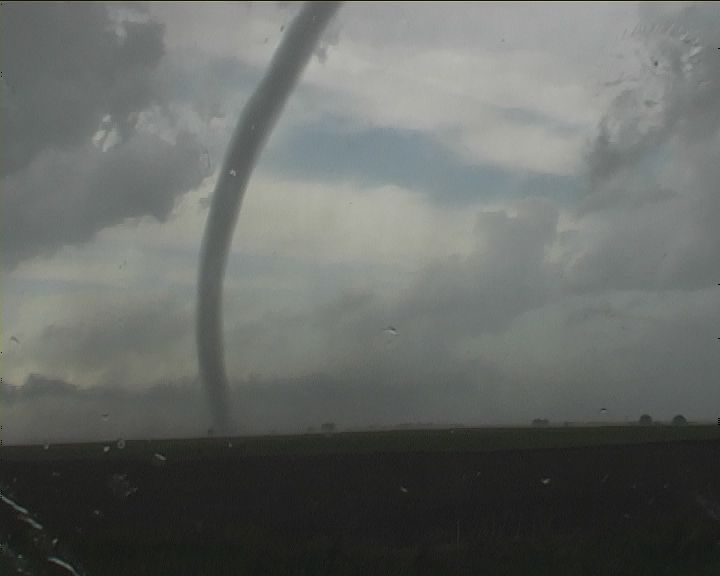
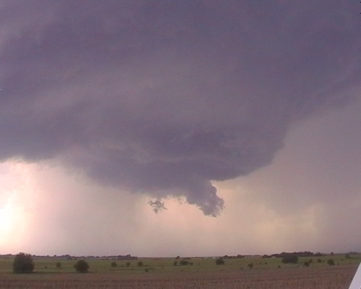
Finally on a descent road, we paralleled this tornado. It had rapidly developed into a stove pipe but contrast was not good here. We made a crucial move east to remain in contact but ahead of the tornado. Another tornado in the meanwhile had developed to our southwest providing an opportunity to film from either side of the vehicle and who knows what else was happening as yet another brief tornadic spinup occurred. But this was the main beast! With rapid rotation, it was churning the countryside � condensation funnel all the way to the ground. It was a large tornado at first gradually evolving into a narrow, strongly-rotating elephant trunk � similar in character to the Pampa tornado in 1995. The tornado seemed to slow down allowing another opportunity to stop and film. The tornado entered the rope stage at this point � narrowing and the condensation funnel thinning out. Tornado over. What? This tornado still showed rapid rotation in the funnel. Debri was still on the ground and the funnel almost invisible. Suddenly the condensation funnel emerges once again into a full rope down to the ground. Incredible! One look at the base and this tornado was alive and still strong � the debri cloud spinning rapidly. Being too close for comfort � we made a hasty retreat. The tornado finally dissipates.
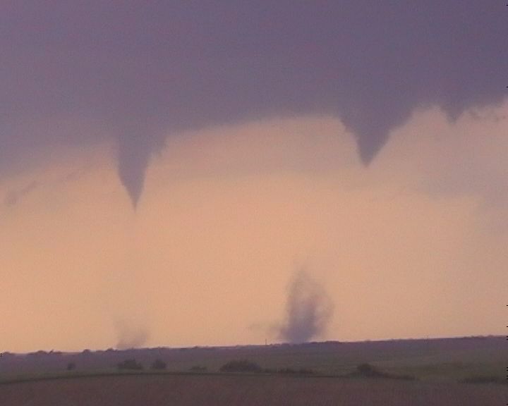
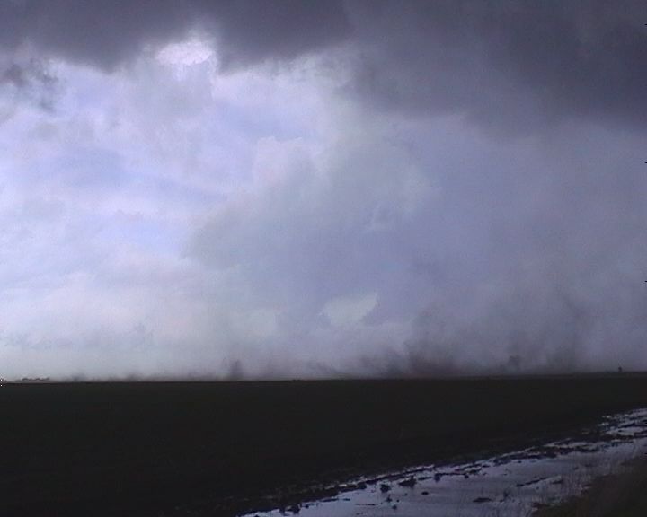
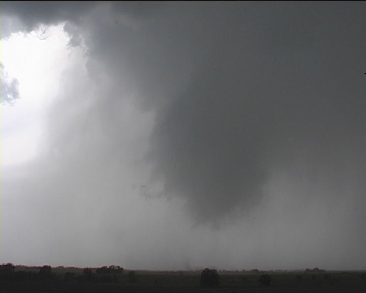
 By this stage, it became a blur. Video shows tornadic spin ups even two at a time and whatever we could see in our field of view. The other tornado was still going churning dust into a sock at the base of the tornado � funnel descending. Then suddenly, the funnel narrows and disappears and the sock ripples into a wedding cake and then down to the ground. After the last mesocyclonic weak tornado, we found ourselves on the south side and not able to be in position for yet another tornado!
So what next! We had been in non-stop action for about 3 hours. We enjoyed the line of large cumulus to our southeast - tops bulging - struggling to break the cap. Until now!
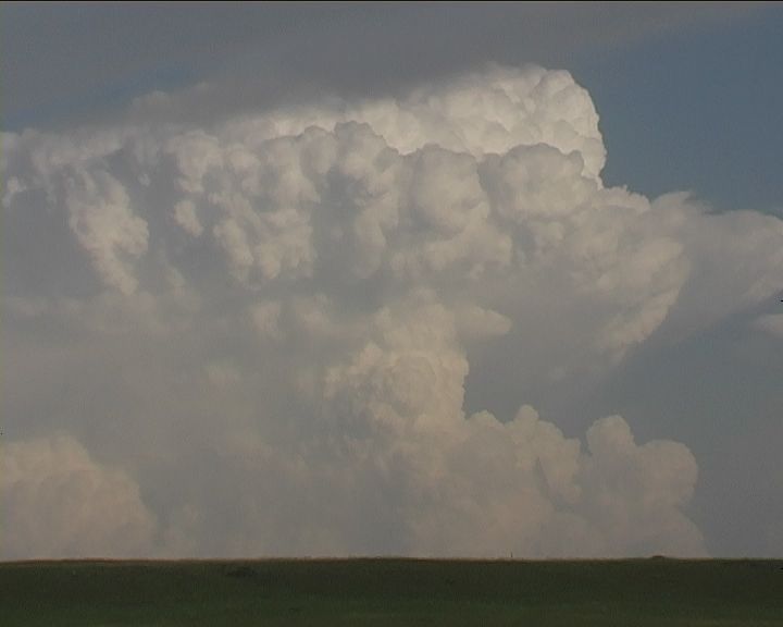
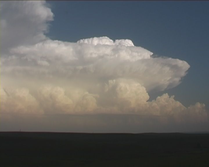
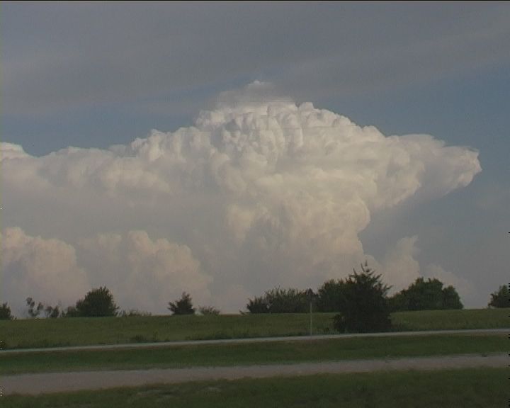 This was to be our next line of activity - target southeast central Kansas. And what an explosion! The first cumulus to break through bulged into a powerful overshoot and spread an anvil. The warnings went from showers to golf ball hail to base ball and finally tornado marning! Unbelieveable! But then a second cumulus tower exploded but this went higher - it just kept going up - I mean how far up can it go! I simply went hysterical - this is what they call 'atomic bomb'. The powerful overshooting dome persisted for some time. The back sheared anvil spread backwards a long way. And don't forget the wind shear was very strong. You guessed it another tornado warning. The first storm had a confirmed tornado and this one followed. We could have intercepted the second tornado as we were in striking distance to Topeka but we gave it a miss. We had to go around the city and onto the other side of the supercell.
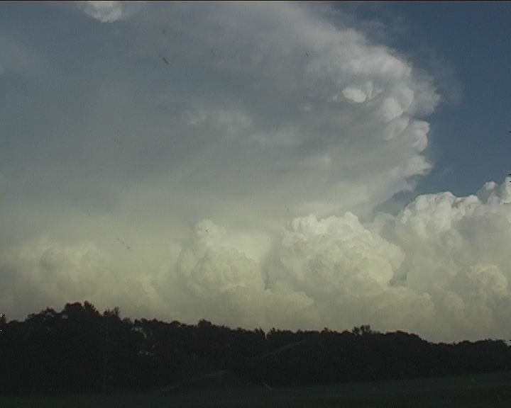
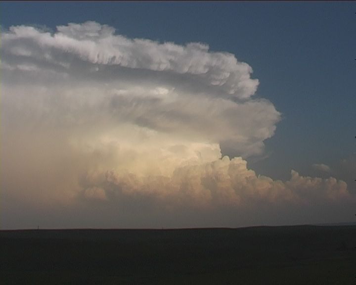 I guess we enjoyed an excellent view of the sunlit cumulonimbus towers. Careful examination of one of the updrafts revealed the real time rotation. This was a bizarre though satisfying day.
Tornadoes 12 May 2004 southern Kansas
29 May 2004 Monster Supercell swipes Oklahoma City
|
Document: 200405-02.html
Updated: 28th January, 2005 |
[Australian Severe Weather index] [Copyright Notice] [Email Contacts] [Search This Site] |